- cross-posted to:
- amateur_radio
- cross-posted to:
- amateur_radio
cross-posted from: https://lemmy.radio/post/3984950
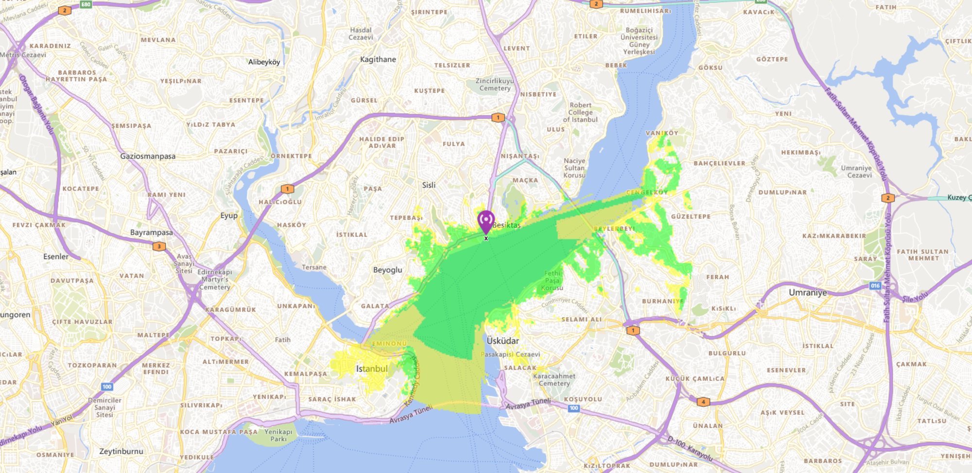
Discover the power of Meshtastic with our step-by-step guide on creating coverage maps for your Lora nodes. These maps are key in optimizing communication range, visually showcasing signal strength and coverage areas within a LoRa mesh network.
LoRA mesh network
I’m not familiar with this.
https://meshtastic.org/docs/introduction/
Meshtastic utilizes LoRa, a long-range radio protocol, which is widely accessible in most regions without the need for additional licenses or certifications, unlike HAM radio operations.
Mmm.
Long range (254km record by kboxlabs)
Generally-speaking, range and data rate tend to move inversely with each other. What’s the data rate?
https://dronee.aero/pages/zoon
LoRa High Data Speed
ZOON can reach up to the data speed of 256Kbps which is suitable for drone and other robotics applications. The speed is highest for modems that use LoRa chirp spread spectrum in the market. The data speed can range from 256Kbps to 0.5Kbps.
Is that just that device?
kagis
No.
https://unsigned.io/understanding-lora-parameters/
LoRa is a very flexible modulation scheme, that can provide relatively fast data transfers up to 253 kbit/s. Conversely, the parameters can be configured in a way that will result in a very low data rate, all the way down to a mere 11 bits per second. This will in turn result in a large processing gain for the receiver, and therefore much longer range of the transmission.
So, there are obviously interesting applications for a radio data network that you can build out yourself without restrictions. But for most day-to-day stuff that I use, the considerably-higher data rates provided by cell phone networks are preferable.
Skimming online, it looks like one group that is really excited about LoRA are hikers, because it gives them the ability to at least get a text message out with their location if they run into trouble in areas outside cell range, and it’s a lot cheaper than having satellite phones. That sounds like a good application.
I can also imagine a lot of interesting things you could do on a farm, do wireless control of equipment and such.
Or with some robots that need to receive occasional commands or send position updates, but don’t need much in the way of bandwidth.
But I’m not sure how many people have an application for which this is a great solution.


